Worldwide urban development, and particularly infrastructure construction, is the principal cause for development-induced displacement. The number of people affected is increasing, impacting the poorest and most marginalised groups like those living in inner city slums without any form of security of tenure, leaving many of them even poorer than before.
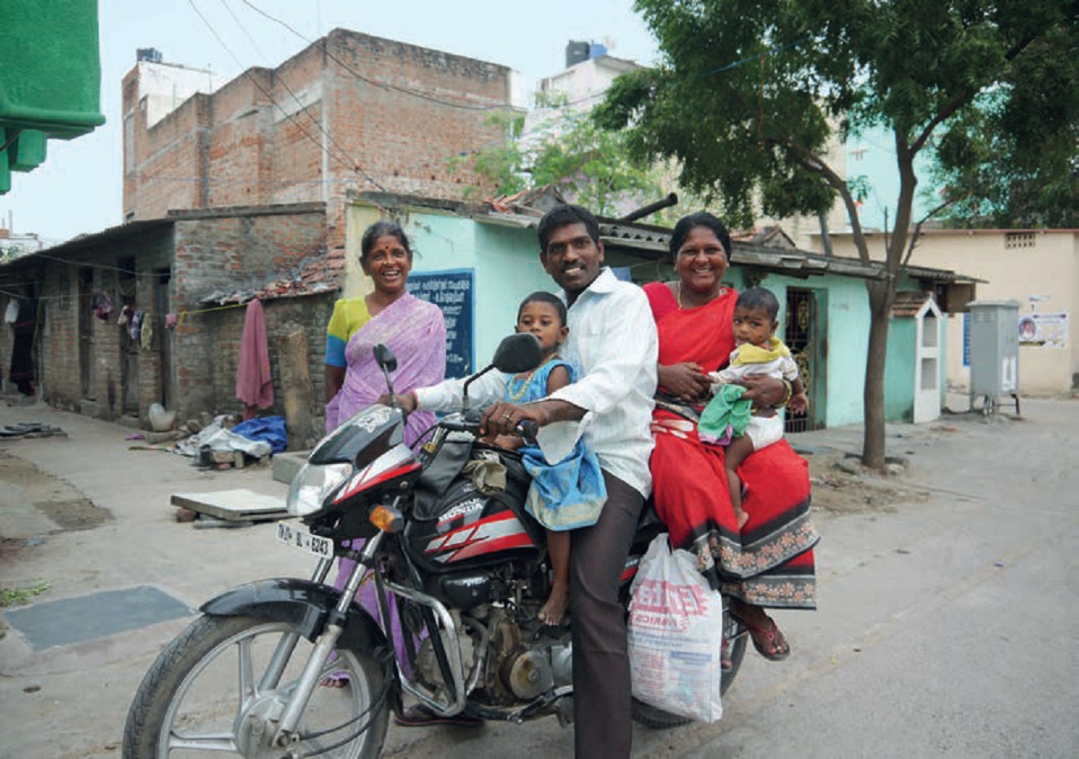
One of the biggest challenges in resettlement is the fact that people are moved so far from their original location, that they cannot continue with their jobs, with women being even more severely affected than men. In addition, when they do continue with their original jobs, travel costs go up, which is an extra burden. One of the ways to deal with the loss of income is through transforming the house in order to create income-earning opportunities and to restore some of the lost income.
This article deals with the extremes of affordability and discusses how former slum dwellers cope with their new living environment in resettlement sites. It will present evidence on the importance of providing opportunities for incremental development for restoring livelihoods and creating assets for those affected, by zooming in on two cases: one from Bangladesh and one from India.
Housing transformation and its importance for livelihoods
When resettlement does not consider livelihood restoration, resettlers struggle to cope with inadequate service provisions and lack of access to jobs. In such cases they react in different ways: adaptation, transformation and mobility. The case studies show the interventions people make to adjust their housing to their needs and how that contributes to the restoration of their livelihoods.
Also, it discusses the moving out of early resettlers due to the inability to cope with the loss of access to employment, but also the assets that are eventually created for those that managed to survive in the resettlement site.
Case 1: Mandartola resettlement site, Gopalgonj, Bangladesh
The resettlers of the Mandartola resettlement site originated from a slum at Gopalganj Sadar comprising of 1935 people and 387 households. In October 2009, the slum dwellers were forcibly evicted and rendered homeless. Houses were destroyed, many people lost their social networks, access to services and some lost their jobs and sources of income. After living on the streets for more than five years, 138 of the affected households were resettled on the Mandartola resettlement site in 2014. The site is located at the periphery of the city and around 10 kilometres from their previous settlement, physically isolated from other settlements by the Dhaka-Gopalganj highway. Every resettler was given a 35 square metre-housing unit with the facilities of one bedroom, one living/dining room, one kitchen, one toilet and an open veranda. Each building block has two separate units, constructed on a raised concrete platform with a brick wall and corrugated iron sheet roofing. No utility services such as drinking water and electricity are available at the location.
Economic impact of resettlement
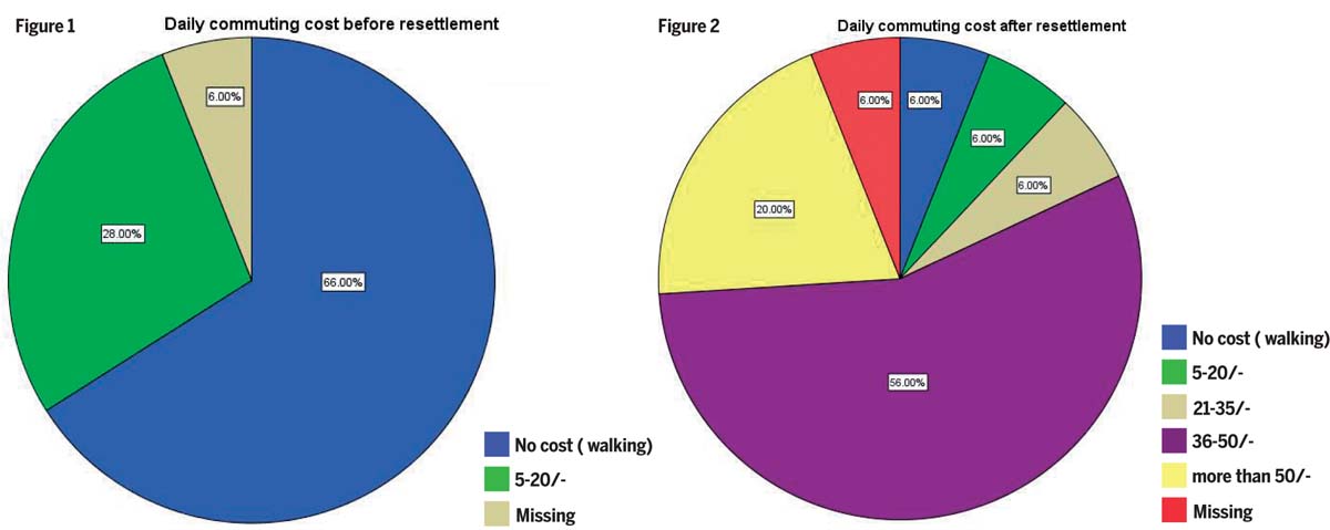
More than half of the respondents became jobless and lost their source of income after resettlement (56%), and half of them (54%), mostly women (77%), were still jobless after four years. Before resettlement, in many families, both husband and wife worked and contributed towards the monthly household income. Many women worked as domestic workers, but had to give up those jobs because of the remoteness of the new location and the time and money it would cost to commute. As a result, the monthly household income of 62% of the respondents had decreased. In addition to this, their daily commuting cost to social amenities such as the bazaar, hospital and school, increased. As compared to their previous settlement where the majority (70%) of the respondents did not spend any money on daily commuting, after resettlement more than half (60%) of the respondents had to spend 36-50 BDT (Bangladeshi Takas) a day (Figures 1 & 2). As a result, those households fell further into impoverishment.
The social impact of resettlement
Because many of the resettlers (62%) were relocated together, their social networks were less affected. For those who were not resettled together with their neighbours, their social ties were negatively impacted. Also, due to the isolated location at the periphery of the city, 56% of respondents did not have any relatives and friends nearby the resettlement site, so they had no one to fall back on in times of need. Moreover, people became more marginalised in terms of lower socio-economic status in the new location due to joblessness and income loss.
Spatial transformation of housing to restore livelihoods
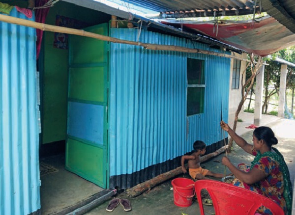
As income after resettlement had decreased, one of the strategies resettlers developed to minimize their income loss was to transform their housing units in order to generate some extra income through home-based economic activities, as well as to reduce expenditure. Resettlers who transformed their housing are more involved in additional home-based economic activities and expenditure reduction activities. Not only did a reduction in household income lead people to transform their house, people who were already struggling to make ends meet also seemed to have been more inclined to this option to enhance their income.
For instance, 36% of the resettlers transformed their verandas into income-generating spaces such as retail shops and working space for producing paper packets.
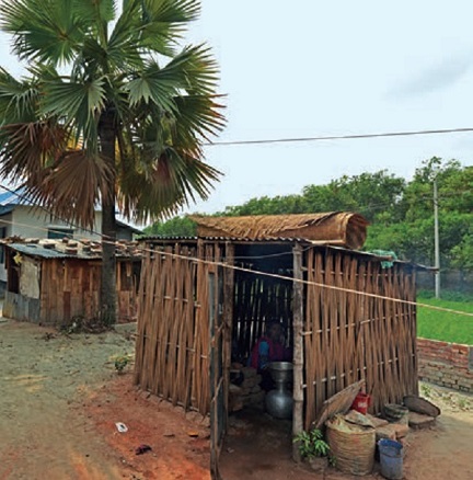
On the other hand, to minimise income loss, some transformations also took place at a settlement level such as the construction of outdoor kitchens, cattle sheds and the planting of vegetation for consumption. Those transformations helped them to reduce their expenditure in order to meet their monthly spending. About 66% of households have been involved in this type of activity. Women in Mandartola are the main actors of these home-based economic activities. As women were more affected by the loss of income, these activities helped them to partially restore their livelihoods.
Spatial transformation of housing to meet social needs
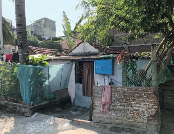
Transformations are also driven by social needs. In Mandartola, 44% of the resettlers constructed additional rooms for expanding families or separate bedrooms as their children grew up. About 60% of respondents functionally changed their housing units, which ranged from changing living rooms, kitchens and verandas into bedrooms.
Social needs also influence people to initiate transformations collectively at the settlement level. Examples of these collective initiatives are the construction of a mosque, a temple, a school and tube-wells for water provisions. Culture and lifestyle also play a role in the need to make changes to the public space in the area. Open spaces within the settlement are types of resources that contribute to the creation of social capital. Resettlers use their outdoor space for household domestic work such as drying of laundry, drying of spices, communal space for sitting and chatting, as areas for children to play and for the organization of social events like marriages, religious festivals, funerals and Kulkhani.
Case 2: Bhim Nagar resettlement site, Chennai, India
Bhim Nagar is a resettlement site in Chennai. In the late 1980s about 15,000 slum and pavement dwellers were relocated to the site from many different localities in the city centre. They were rehoused 15 kilometres away, outside the Chennai Corporation border, on a site that used to be part of a lake, which was partly filled up by the Chennai Corporation, but flooded during the rains.
The Tamil Nadu State Government and the Government of India financed the project and the Tamil Nadu Slum Clearance Board (TNSCB) was the implementing agency. Development of the site and construction units was carried out in four phases between the late 1980s and early 1990s. The site was still under construction when the first resettlers moved into the area. At the time of moving in, the roads were unpaved and would flood during the monsoons, which made it impossible for water trucks to enter. As no waste was being collected, the inhabitants used to throw their waste in the neighbouring lake or burn it. Several communities from different localities were relocated in the same site, which led to tension and conflict between the various groups. And their local leaders were in conflict over who was in charge of Bhim Nagar. Also, there was a lively trade in drugs and liquor.
Every family was given a house of 4.5 by 5.5 metres. They had to pay Rs. 66 as land cost and Rs. 10 for maintenance per month over 21 years, after which they would receive a title deed.
Plot transfers in 1989-1990
A survey conducted in 1989-1999 revealed that there was an active trade in plots. Seventy-six percent of the respondents in the random survey were an original allottee, 19% had bought a plot and 5% were tenants.
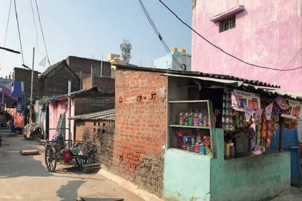 | 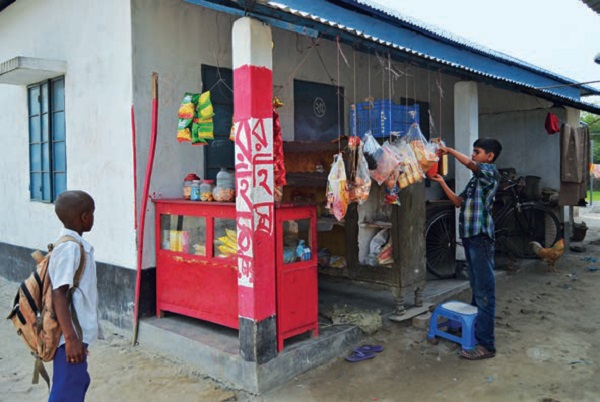 |
Right: Social infrastructure constructed by the resettlers
In some parts of the resettlement site, the transfer of plots was even as high as 36%, possibly because of the particularly active involvement in the ‘plot business’ of the local leaders.
Many of the original allottees generally left Bhim Nagar due to lack of access to employment and proper transportation facilities. People were working as informal daily labourers, in construction and as coolies at train stations, often requiring proximity to the city centre. Others were working as fishermen and used to live in slums close to the seaside. Women were also heavily impacted. Many of them used to work as domestic workers close to their homes in the slums. Later, because of the distance, they had to abandon their jobs as it was impossible to combine them with their household responsibilities. Those who were unable to find alternative employment moved back to the city and sold or rented out their plot on the site.
On the other hand, buyers came to Bhim Nagar because they realised that over time the area would improve and land prices would rise, as the area would be integrated in the city. Some only bought a plot as an investment and rented it out to others. Some moved in a bit later when it was more developed and still others only bought it to rent it out.
As tenants were ineligible to resettlement, they had no other option than to rent a place in Bhim Nagar when their settlements were demolished.
Several local leaders in Bhim Nagar played a mediating role in the trade of plots, which was a profitable business. They were involved in reconstruction and selling of houses and plots and the contractual arrangements between buyers and sellers.
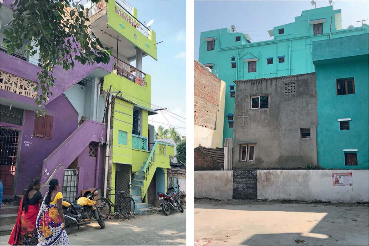
Housing transformation in 2017
Another survey was conducted in Bhim Nagar in 2017 with households who were living at the same address since 1999-2000. By now the area had transformed immensely. Although there were some households that were still experiencing the same conditions they had in 1999, overall the outlook of the area and the quality of housing had totally changed. Many houses were expanded to several floors, some were merged into bigger ones, verandas and rooftops were constructed and roads were paved.
The survey revealed that the number of original allottees had decreased considerably when compared to 1989-1999 from about 30% as compared to 76%. The number of tenants had also decreased, although less drastically, from 5% to 0.5%, which presumably is not totally correct as observations revealed the number of rooms has gone up considerably. It is suspected that respondents are hiding the true number of tenants. There is also a discrepancy between original allottees and new tenants who were using the same door numbers. The number of buyers has gone up drastically from 19% in 1998-1999 to about 70% in 2017.
 |  |
Only 4% of the original allottees have paid off their full instalment. In those cases, people are entitled to receive an allotment order handed out by the TNSCB. In reality, only seven respondents received an official document. Most respondents are unaware of the procedures and the fact that they are entitled to receiving this document upon full payment. However, even without official ownership documents, 37% of the original allottees transformed their house.
More than half of the buyers (61%) transformed their house, mostly because the quality of the house was considered poor and too small. Roofs were changed, houses were plastered, extra floors and verandas were added, bathrooms were constructed and internal designs altered. Most transformations are made either to accommodate a growing family or for renting out rooms. There are for instance a substantial number of people from Manipur who work in the neighbouring malls and parlours and rent rooms in Bhim Nagar. That way the transformation provides for extra income-earning opportunities, creating assets for people who never had any earlier. So this is a means to move out of poverty for those who managed to survive the very tough early years after resettlement.
Conclusion
As research has shown, resettlement often leads to impoverishment for the overall majority of those affected; this should be minimised as much as possible. When there is no other choice, people should be moved as close as possible to their original homes as access to jobs is of crucial importance. In cases when that is not possible, livelihood restoration is the most crucial element.
The two cases presented have shown that affected communities are very creative in adjusting their houses and public spaces incrementally to their needs; either through moving out whenever there is no other way possible or adjusting their housing and public space with the little means they have in order to restore some of their lost income. It shows the importance for affected communities to be involved in the design of their houses and in providing them with the possibility to incrementally adjust their housing to their needs and life stages. This can happen through extensions, readjustments of internal designs, by adding extra floors and verandas. Thereby opportunities are created to build up financial assets that in the end can provide poor resettlers with the opportunity to move out of poverty.

Comments (0)