Design in today’s context – whether in the form of graphic design, product design or design strategy – does not come cheap. The very word brings an expensive luxury to mind, sparking off debates on necessity and possible alternatives. Spending time and effort in reimagining an entire ecosystem, user experience, usability and presentation suggest a disruption of the current model; clearly an unaffordable choice to the traditional manager.
Ironically, it is very much in the power of design to innovate for lower costs, better processes, higher efficiencies and superior quality of offerings. Following frameworks and strategies for cheaper manufacture, execution and maintenance, designers are busy challenging established models of mass manufacture.
Sidestepping industrial production altogether by customers connecting directly with makers for custom goods, a new wave is being facilitated by the information age. With access to new technologies, communication tools and connected markets, designers are redesigning the supply chain to redefine affordability for their customers. Take for instance Knyttan, a British start-up that allows customers to design their own knitted garments through majority ownership of the production vertical. This allows for custom made, high quality garments that are an affordable luxury for the middle class.
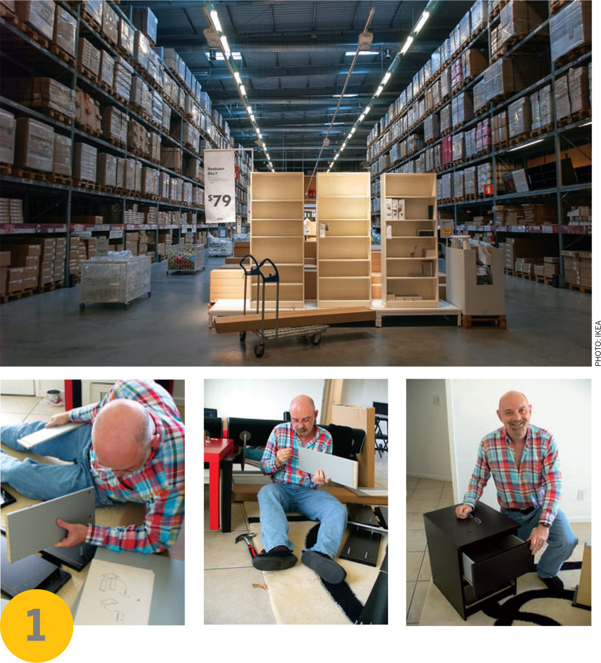
Offsetting a part of the product assembly cost to customers themselves has proven a winning strategy for IKEA. The largest furniture retailer in the world has consistently offered elegant and inexpensive goods through intelligent design that are ready-to-assemble. Apart from saving time, space and high delivery costs, clever details allow for assembly using very simple and strategic tools, even offering a sense of accomplishment to customers. What could be better than cheap furniture that makes you feel good about yourself?
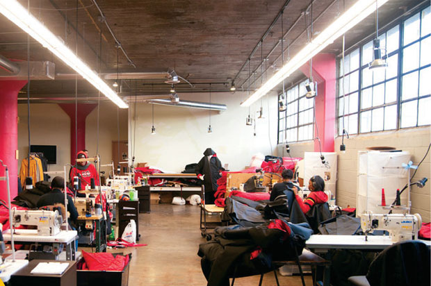
Going a step further by actually employing a part of its customer base to manufacture its product, The Empowerment Plan, a non-profit organization in Detroit, is breaking new ground. Addressing the high number of homeless city residents, Veronika Scott designed a self-heating and water-resistant sleeping bag cum coat to help them get through the frigid winter. Now employing 20 previously homeless Detroiters as seamstresses, Veronika has even created opportunities for them to break away from the cycle of homelessness. Such is the diverse influence of design!
Exploring a fresh strategy to lower costs in a water scarce region of South Africa, Peter Krige has re-imagined the very components of a product that make up the desired experience. Instead of designing an object with several elements, materials and functions, Peter decided to leverage existing user infrastructure to attain the same functionality. Designing a pressure- tight enclosure that can be fitted to a variety of readily available plastic water containers, his Ekasi Water Cap offers a previously unavailable pressurized water stream for daily activities like showering, rinsing dishes and washing clothes.
As demonstrated by a new generation of designers, the key to competing on price in today’s markets is to leverage design not only for aesthetics but also for strategy and systems thinking. Even then, looking beyond just price is progressively becoming critical: what could be some future differentiators affecting choice and affordability? With users attaching more importance to life experiences than materialistic goods, how can future products drive such experiences? While customer service and emotional attachment increasingly help gain the edge, are we close to when time will define a new era of competition? The time it takes to charge a cell phone, install a lamp, make a call and unlock the door? Only time will tell.
IKEA>Almhult, Sweden>1943-present
Ingvar Kamprad
With its ‘democratic design’, IKEA aims to design for the masses. Visiting thousands of homes around the world each year, their design process begins with understanding unmet needs and gathering actionable insights. There is a strong belief in partnering with users themselves where each do their part, and thus together they save money.Working directly with various suppliers, the production process focuses on close partnerships and collaborative problem solving. Focusing more and more on sustainability, the multinational group is continuously evolving their products, material selection and energy sources.
Operating 373 stores in 47 countries, IKEA demonstrates that affordability can be scaled up.
Additional info: www.ikea.com
The EMPWR Coat, The Empowerment Plan>Detroit, United States>2011-present
Veronika Scott
The EMPWR coat is a water-resistant and self-heating jacket, which can transform into a sleeping bag, or be worn as an over-the-shoulder bag when not in use. The coat is constructed of upcycled automotive insulation, fabric from Carhartt, an apparel retailer, and other materials provided by generous donors.
The Empowerment Plan can produce 1,000 coats on a budget of $100,000. For each 1,000 coats distributed, they can save 14 lives and reduce healthcare costs by $58,800 annually. Part of their vision is to expand this model to other cities as they recognize that extreme poverty is not unique to Detroit.
The Empowerment Plan employs over 20 previously homeless Detroiters and provides warmth to almost 9,000 homeless individuals across the .United States
Additional info: www.empowermentplan.org
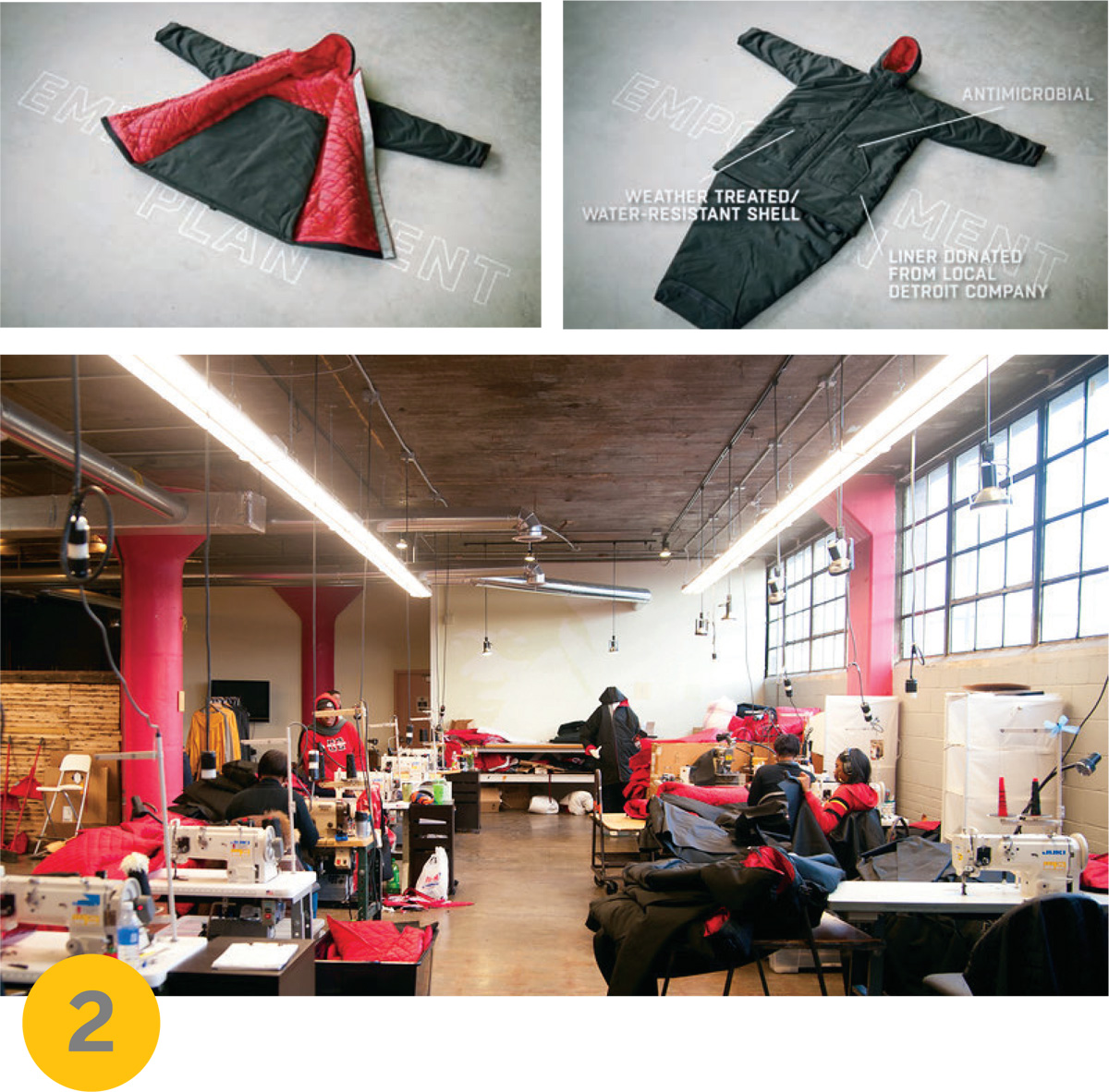
EKASI Water Cap>London, United Kingdom> 2012-present
Peter Krige
The Ekasi Water Cap is a specially designed pressure tight closure that transforms locally available parts – a standard 25 litre water container (commonly used for water collection and storage in unplumbed homes), plastic piping and a bicycle pump – into a portable pressurized shower unit. A plastic shower-head with a built-in trigger allows for more controlled water flow.
This setup was used in a trial in Khayelitsha, South Africa in January 2014. In this part of Khayelitsha, water is only accessible through ‘Community Street Taps’, located along the street and each shared by a minimum of 20 homes. There is no plumbing and direct access to water in a house, making the Ekasi Water Cap all the more relevant and valuable.
This project is an exploration of appropriate and human-centred technology, where simple inventions introduced to an underserved user group in the right form can be enabling, and improve overall quality of life.
Additional info: www.peterkrige.co.uk/Ekasi-Water-Cap
ALL PHOTOS: DESIGNNERS

Comments (0)