Only a few years ago the United Nations Educational, Scientific and Cutural Organisation (UNESCO) presented its recommendations on the Historic Urban Landscape (HUL). The HUL offers a more dynamic approach to the conservation of valuable historical cities than usually practised, linking conservation to development. So far however the implementation of the HUL-approach seems to have been entangled in academic debates, leaving the urban managers on the ground empty handed. In an attempt to provide the historical features of Ternate City (Moluccas, Indonesia) with a vital future, the Ternate Heritage Society looked for a practicable implementation of the HUL-approach. Colleagues from the Netherlands supported them in this effort.

 |
INTEGRATED CONSERVATION
On November 10, 2011, the 36th session of UNESCO’s General Conference adopted the so-called Recommendation on the Historic Urban Landscape. By doing so, the General Conference recommended its member states to act according to the approach as developed by the committee it had installed several years before. The reason for installing this committee was UNESCO’s observation that “rapid and frequently uncontrolled development is transforming urban areas and their settings”, resulting in “fragmentation and deterioration [of] urban heritage with deep impacts on community values throughout the world”. The solution, as proposed by UNESCO’s committee and thus adopted by the General Conference, had to do with integrating the conservation of heritage in the planning discipline.
The message conveyed by UNESCO through the HUL-approach can be considered a redefinition of the policy earlier known as Integrated Conservation. In the Declaration of Amsterdam, the Council of Europe formulated the concept of integrated conservation in 1975. Since then it has evolved in several subsequent documents, most notable being the International Council of Monuments and Sites’ (ICOMOS) Washington Charter of 1987. Heritage Conservation in this notion is understood in a holistic way, not as an autonomous activity, but as part of a planning process.
The importance of UNESCO’s redefinition of HUL resides in the notion that it incorporates a capacity for change.
The historical urban landscape is not considered a static object, but a dynamic subject, constantly adapting to changing circumstances. Change – in this notion – is considered to be an inclusive and essential element of the historical identity. Excluding change would after all be a rather ahistorical premise, since history is determined by change. Consequently, conserving the historical urban landscape is rather a matter of managing change than of physical preservation. This way, heritage conservation enters the paradigm of urban management, fostering social and economic development.
Once heritage conservation has found its place within urban management, it should adapt to the latter’s discourse to be effective. If it does not speak the same ‘language’, it will not be understood. And this is exactly where so far the application of the HUL-approach seems to fall short. Most of the HUL inspired endeavours – be they in Hyderabad, on the Swahili coast or along China’s Honkou River – excel in validating all possible tangible and intangible qualities, actively engaging public, private and civic sectors. We should of course be grateful for the initiative. But at the same time we should realise that validating historical features is most insufficient as a conservation strategy. In order to provide the historical features at stake with a base of existence we should rather look after future perspectives. The distinctive nature of Integrated Conservation lies in defining the development potentials that the historical urban landscape offers. In the case of Ternate City, this happened to be the way out of the HUL-dilemma.
THE CASE OF TERNATE CITY
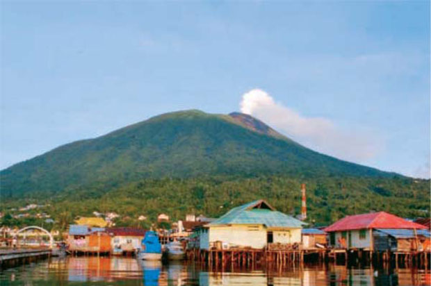
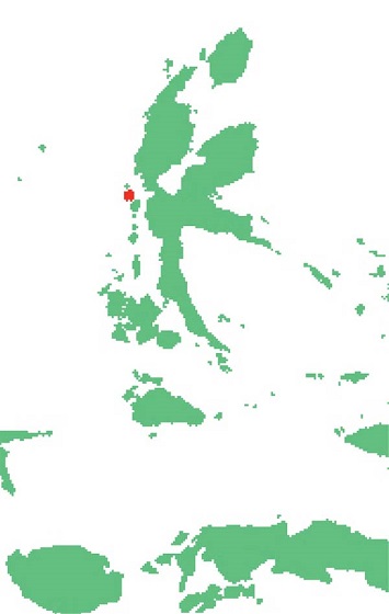
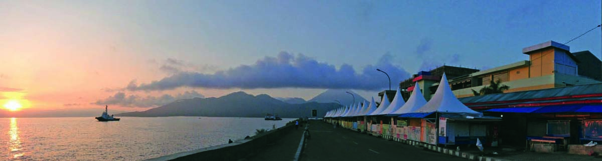
Ternate City is located on the volcanic island bearing the same name. The small island is part of the extended Maluku Archipelago in eastern Indonesia. Ternate and the neighbouring island Tidore are situated of the west coast of the larger island of Halmahera. Its 92 square kilometres of area is dominated by the volcanic Mount Gamalama, reaching 1715 metres out of the sea.
Till today, the Gamalama volcano is active. Its last eruption occurred in 2011, blowing ashes up to 2,000 metres in the sky. Due to volcanic outbursts and steep mountain slopes, the area fit for urban expansion of Ternate City is limited to the south-eastern quarter of the island. As a port city and a centre of economic activity in the North Maluku province, Ternate became a hectic city that suffers from over-development. Since it was appointed capital of the newly founded province of North Maluku in 1999, the city grew rapidly. Today, Ternate City is the largest city in the province of North Maluku, with a population of over 200,000 people. It is however no longer the provincial capital; a title now held by the town of Sofifi on Halmahera.
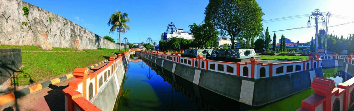
We know Sampalo as the seat of Ternate’s first Sultan in the 13th century, but as a settlement it must be older than that. During the reign of Ternate’s first Sultans, the island opened up to merchants from far outside the region. Traders from China, India and Arabia were all eager to buy the much-desired cloves that grew abundantly on the trees on the volcanic soils of the mountain slopes. The precious commodity allowed the Sultans to become amongst the wealthiest and most powerful rulers in the region. Ternate became the dominating power over most of the Spice Islands of the Maluku Archipelago. Soon, European traders found their way to the fabulous spice island, causing dramatic and lasting changes to the island of Ternate. The Portuguese were the first of the European powers to reach the island in 1512. After being expelled from the island in 1574, the Spanish managed to conquer it. The Sultan’s family meanwhile fled to the island of Halmahera. In despair, the Sultan’s heirs turned to a new rising European power, even fiercer competition to the Spanish than the Portuguese were before. The Dutch trading company Verenigde Oost Indische Compagnie (VOC), eager to gain a monopoly over the island’s spice trade, willingly helped restore Ternate’s Sultanate. In return the Sultan would sell all future cloves only to the VOC. To consolidate the new balance of power, the VOC built Fort Oranje in 1607 on the east side of the island, north of the Gamalama Fort.
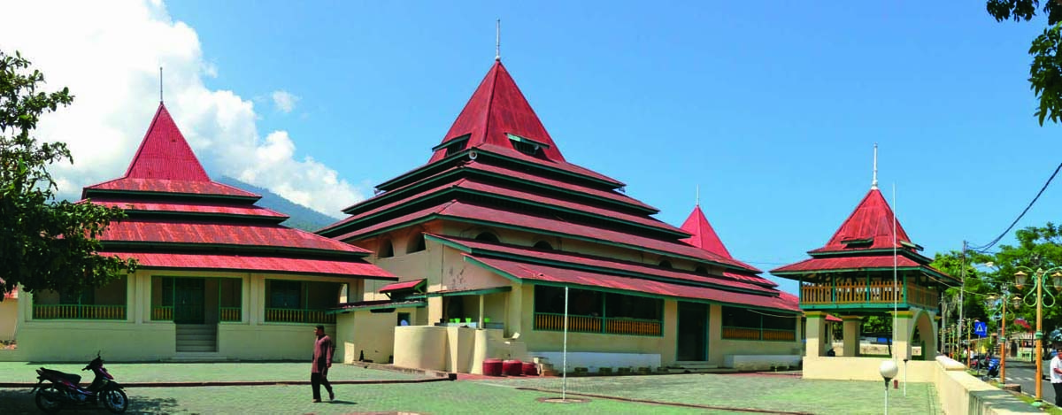
The new powers divided the people of the island against one another, consolidating their powers politically and spatially. North of the Dutch fort, the Sultan constructed a new stronghold (Kadaton), strategically located on a hill overlooking the islands of Halmahera and Tidore. The loyal clans settled around in the area that became known as Soa Sio (Nine Clans). Here also a new mosque (Sigi Lamo) was built, as well as a courthouse and jail (Ngara Lamo), bathing complexes (Ake Santosa) and open public spaces (Sunyie Lamo and Sunyie Ici). In front of the Kadaton were the ports (Dodoku Mari). The Dutch territory covered the area south of Soa Sio. The so-called Malayo area around Fort Oranje was divided into several quarters according to the ethnicity of its inhabitants, consisting of Europeans, Chinese, Arabs and people from Makassar. This marked the beginning of today’s city of Ternate. Each gave its own flavour to the city’s culture as is still apparent today; be it in language, cuisine, clothing or architecture. After VOC’s bankruptcy around 1800, the Sultan lost his say over the area to the Dutch colonial government. Soa Sio became just another quarter of the divided city, adding to the mix of cultures.
After Dutch colonial rule ended in 1945, the status of Ternate’s Sultanate was reduced to a small city district under the province of Maluku with its capital in Ambon city. At this time, the city of Ternate did not experience significant growth. However, this changed quite dramatically when Indonesia turned to the policy of Otda (regional autonomy) in 1998. As a result, Ternate gained the status of a City Municipality (Kota Madya) in 1999 and became the capital of the newly established province of North Maluku. Ternate City once again started to experience an extremely rapid growth. Due to lack of urban space, the city expanded into the sky by constructing high-rise buildings, into the sea by land reclamation and into the mountain by excavating the steep slopes. Vulnerable urban qualities are at stake now.
POTENTIALS
Ternate’s current challenge is to re-create a city centre that is attractive for living, working and leisure time.
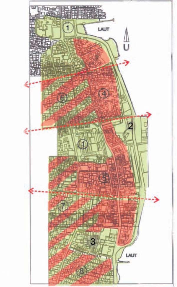
The Ternate Conservation and Development Workshop, as initiated by the Khairun University of Ternate in collaboration with the Ternate Heritage Society, investigated ways in which the historical urban landscape can serve this goal. The workshop was conducted in 2012 in collaboration with the Planning Board of the City of Ternate and was supported by the Cultural Heritage Agency of the Netherlands. The results of the workshop were presented to the local authority as an input for the urban development plan to be drawn.
During the workshop a quick scan was executed, providing the data to determine the development potentials of the historical features at stake and to calculate the restoration needs. The quick scan method as applied by the workshop was derived from the Dutch experience in inner city renewal during the last quarter of the 20th century. During this time, Dutch municipalities (as well as many other European municipalities) turned out to be quite successful in revitalizing their dilapidated city centres. Most notable is how historical features were used as a strategic asset to reach this goal. Today’s city of Amsterdam for example is favoured for its historical ambiance, while in the 1970s it was a place where residents moved out, investments failed to materialise and visitors had to avoid its many no-go areas.
Based on the quick scan, the workshop has been able to define the development potentials of Ternate’s historical features. New (social and economic) impulses fostering or strengthening the historical features were identified and mapped. Likewise, developments with a negative impact on the historical features. Most notable development opportunities are in the precincts around the Kadaton, Sigi Lamo and Fort Oranje. These precincts offer opportunities for new cultural, educational, leisure and tourist activities thus improving the attractiveness of the city centre. Restoring the relation and views of the city with the sea and the volcano also improved the quality of the city centre. New services could be accommodated in the historical structures near the harbour, thus strengthening the city’s position as a centre of facilities and meanwhile providing a new base of existence for these historical structures. The expanding retail trade and the uncontrolled development of high-rise structures, as well as the traffic congestion threaten the city’s liveability. They should somehow be restrained.
IMPLEMENTATION
This workshop managed to bridge the gap between HUL’s theory and practise, providing the local authorities with relevant policy advice. A clear and well-enforced municipal development plan will stimulate the favoured investments and will be supportive for residents investing in the upkeep of their property. Undesired investments meanwhile will be confined. Historical features thus are strategically deployed to improve living conditions and to serve current social needs.
Ternate City meanwhile has executed the refurbishment of Fort Oranje, improving the attractiveness of the city centre. Yet, so far, a comprehensive development plan for the fort area is missing. The Ternate Heritage Society in its turn meanwhile supports the urban regeneration by raising public awareness for the historical features. For this reason it developed a well-received heritage trail, including education and recreation.

Comments (0)